Creating a search area
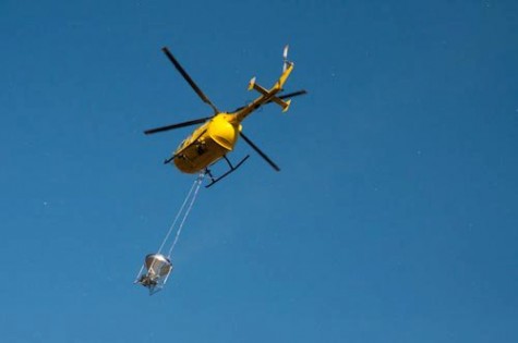
This is a picture of helicopter AM with the bait spreading hopper attached. The bait sprays out of it spreading at a rate of 53 pellets per 20m square. The pilots have to be incredibly skilled in flying their grid patterns to ensure complete coverage of the ground.
The Hopped on TC last week came off while over King Edward Cove. The emergency release was set too sensitive (at least that is what they think) and off it fell. Since then I have spent quite a few hours trying to figure out a search area for diving. Collecting together all the information we have a 180 foot by 95 foot area and I have made concrete weights so we can put shot lines down in the four corners of the search area. Tomorrow monday we will first do a sonar search in the area to see if we can identify it that way.
I was able to create the search area using the following information.
1) Photos taken by Pat from his kitchen that show it floating before it sank. He took three photos a minute apart. Then he corrected the camera time to GMT by taking a picture of a GPS with GMT time on it. From that we were able to figure out the rate and direction of drift on the surface and we know that it sank before 22 minutes past the hour as that is when the helicopter was back on the pad at Grytviken. We took the co-ordinates of where he took the photos from and plugged them into GPS program. Next I took a transparant film and drew out the relevant landmarks so I could line them up with the shore on the otherside of the cove. I ran around the cove until I was in line with the position of the bucket when the last photo was taken and took a GPS position. We used these two positions for our first transit.
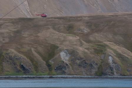
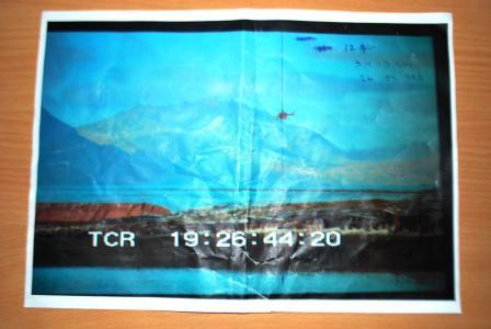
Photo by Pat of the helicopter over the hopper just before it went down.
2) The second transit taken from the photos was found by dead reckoning the maximum drift before it sank. This time Sam ran around with the GPS and I told her right and left a bit until she lined up correctly with the estimated position. This position was then put in the program.
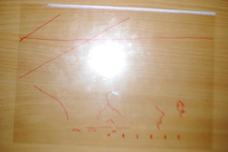
Transparacy to site through with dead reckoning positions
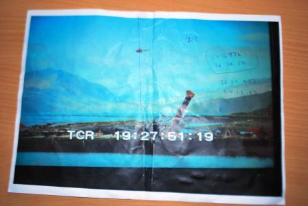
3) Luckily the GEO camera crew had video footage of the helicopter hovering in the two positions after losing the hopper and these were about 90 degrees from the photos. So they found the footage and we took a GPS position of where they had been filming from. We then took a photo of their two sections of video on pause. I biked around to the position that they had filmed at and took two compass bearings to find the position of the first and second hover.
4) The helicopter had a GPS aboard however, there wasn’t a button to press to save a position however, the pilot radioed it back to the pad. That position was on land so we had to create an offset. When the helicopter was sitting stationary on the pad we had the position from the tracking device and the helicopter GPS position with some simple maths we had an offset. This created another point on the search chart.
5) When the helicopter was stationary we took a position of it on the pad and plotted that. Then we entered into the helicopter GPS the position that the pilot read out and it gave us a range and bearing to it from the helicopter. I put this as another transit into the GPS program.
6) We had the position of the jet boat when we called off the search and also the position of the two dives that were attempted so yet more information to add.
7) We had the two hover positions from the helicopter tracker. The helicopter hovered once over it while it was moving and then moved away to allow us in the jet boat to approach so it had to move away.
8) The last bit of information was to get the pilot to fly back to the position on his GPS and throw out of the window a weighed shot line with a bouy on the end. We then went and took GPS co-odinates of it and put that in the mix. This ended up in the center of one of the search area boxes so we will probably start with that box first if the sonar comes up with something of interest.
So lots of information on the chart. This week will show us whether the information is useful and if so we will have the hopper back on dry land. Quite an interesting bit of detective work 🙂
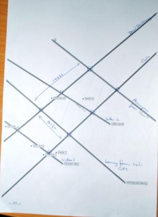
End result…


