Weather down here

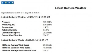
One of the harder things to get across to the scientists is that weather is a large factor in planning. Above is the information permanently on our computer screen. When there is a crosswind it flashes red so we are ready to scrabble for SAR requirements.

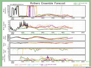
We use a program called Ensemble as well as having a full time Met Office Forecaster on station. It has 5 different models which tell you what to expect for the next 5 days.
Every morning at 7:45am the boatman is at the ops meeting to get the METARs and TAFs (Terminal Aerodrom Forecast) and also understand the Air SAR requirements for the day. The METARs look something like this…
EGAR 231000Z 06007KT 1000 -SN OVC015 MO1 MO2 Q974=
Translated that means
EGAR = station
23 = Date of issue
1000Z = Time in Zulu
060 = bearing in T
07KT = wind speed
1000 = horizontal distance visibility in meters
-SN = slight snow
OVC = type of cloud
015 = cloud height of 1500 feet
M01 = current temperature in C
M02 = dew point C
Q974 = sea level pressure MB
The TAFs look like this
EGAR24100Z 2412/2424 06013KT 5000 HZ BKN016 TEMPO 2412/2416 1200 SNBKN012 TEMPO 2412/24150300 SN BR BKN005 BECMG 2414/2417 09022G32KT 999 SCT025 BKN025=
So from that I get the forcast that was issued at 1000Z for rothera on 24th that covers 1200Z to 2400Z on the 24th of 060 degrees wind at 13 knots with a temporary change between 1200 and 1600 becoming 090 at 22 knots with gusts 32 knots.
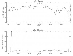
We also have another lot of information on the screen this is plots showing us the historic trends in wind direction, speed, temperature etc.

On top of all this we have HORACE which is the met offices program with animated weather charts.

